GENERATIONAL POINTERS
Agrii agronomist Todd Jex gets a steer from his grandfather on how he’s putting new
tech into practice.
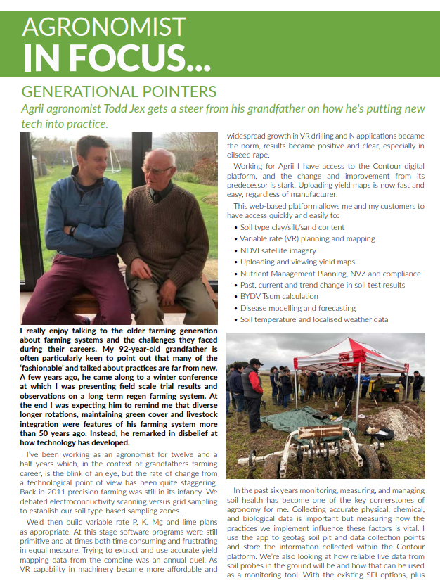
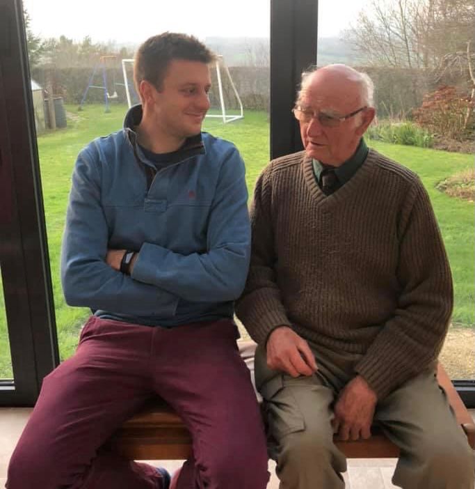
I really enjoy talking to the older farming generation about farming systems and the challenges they faced during their careers. My 92-year-old grandfather is often particularly keen to point out that many of the ‘fashionable’ and talked about practices are far from new. A few years ago, he came along to a winter conference at which I was presenting field scale trial results and observations on a long term regen farming system. At the end I was expecting him to remind me that diverse longer rotations, maintaining green cover and livestock integration were features of his farming system more than 50 years ago. Instead, he remarked in disbelief at how technology has developed.
I’ve been working as an agronomist for twelve and a half years which, in the context of grandfathers farming career, is the blink of an eye, but the rate of change from a technological point of view has been quite staggering. Back in 2011 precision farming was still in its infancy. We debated electroconductivity scanning versus grid sampling to establish our soil type-based sampling zones.
We’d then build variable rate P, K, Mg and lime plans as appropriate. At this stage software programs were still primitive and at times both time consuming and frustrating in equal measure. Trying to extract and use accurate yield mapping data from the combine was an annual dual. As VR capability in machinery became more affordable and widespread growth in VR drilling and N applications became the norm with the results being positive and clear, especially in oilseed rape.
Working for Agrii I have access to the Contour digital platform, and the change and improvement from its predecessor is stark. Uploading yield maps is now fast and easy, regardless of manufacturer.
This web-based platform allows myself and my customers to have access quickly and easily to:
• Soil type clay/silt/sand content
• Variable rate (VR) planning and mapping
• NDVI satellite imagery
• Uploading and viewing yield maps
• Nutrient Management Planning, NVZ and compliance
• Past, current and trend change in soil test results
• BYDV Tsum calculation
• Disease modelling and forecasting
• Soil temperature and localised weather data
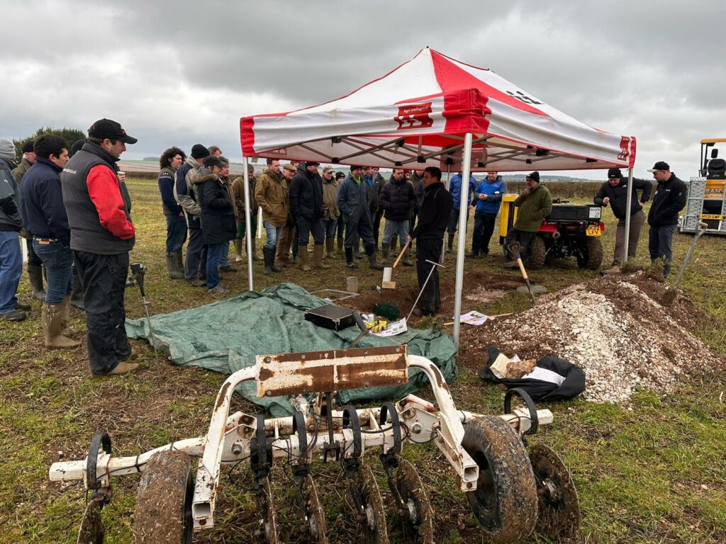
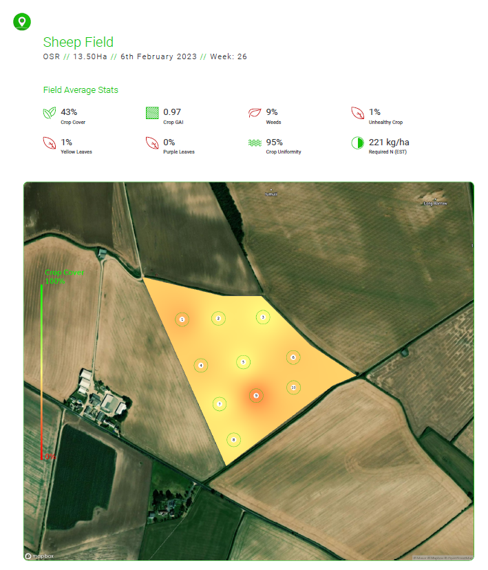
In the past six years monitoring, measuring, and managing soil health has become one of the key cornerstones of agronomy for me. Collecting accurate physical, chemical, and biological data is important but measuring how the practices we implement influence these factors is vital. I use the app to geotag soil pit and data collection points and store the information collected within the Contour platform.
We’re also looking at how reliable live data from soil probes in the ground will be and how that can be used as a monitoring tool. With the existing SFI options, plus future options on the horizon, and developing carbon markets there should be an increased emphasis on collecting accurate and meaningful baseline data.
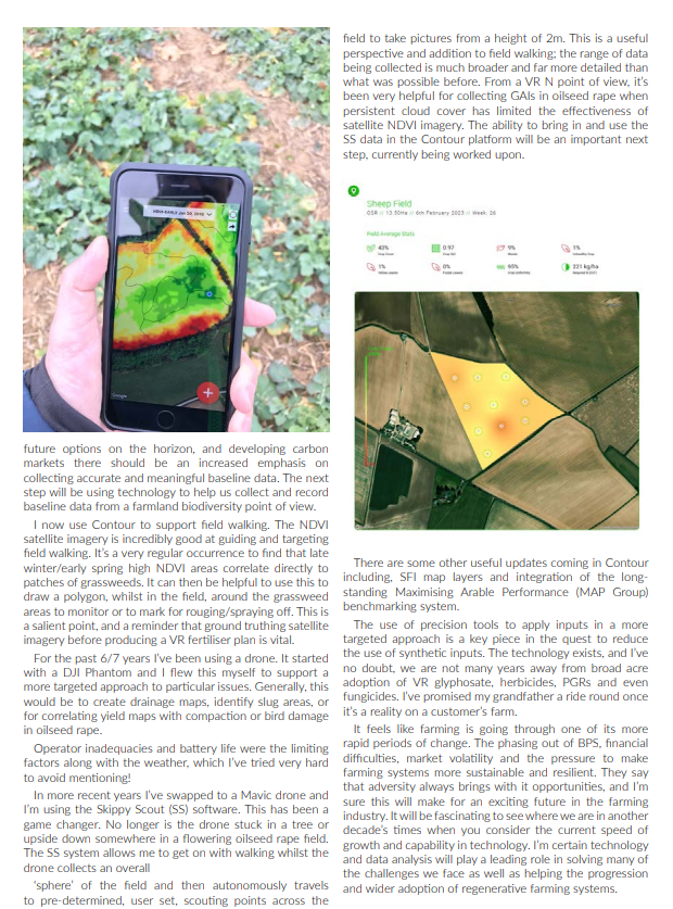
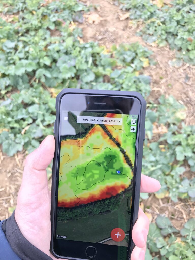
The next step will be using technology to help us collect and record baseline data from a farmland biodiversity point of view. I now use Contour to support field walking. The NDVI satellite imagery is incredibly good at guiding and targeting field walking. It’s a very regular occurrence to find that late winter/early spring high NDVI areas correlate directly to patches of grassweeds. It can then be helpful to use this to draw a polygon, whilst in the field, around the grassweed areas to monitor or to mark for rouging/spraying off. This is a salient point, and a reminder that ground truthing satellite imagery before producing a VR fertiliser plan is vital.
For the last 6/7 years I’ve been using a drone. It started with a DJI Phantom and I flew this myself to support a more targeted approach to particular issues. Generally, this would be to create drainage maps, identify slug areas, or for correlating yield maps with compaction or bird damage in oilseed rape.
Operator inadequacies and battery life were the limiting factors along with the weather, which I’ve tried very hard to avoid mentioning!
In more recent years I’ve swapped to a Mavic drone and I’m using the Skippy Scout (SS) software. This has been a game changer. No longer is the drone stuck in a tree or upside down somewhere in a flowering oilseed rape field. The SS system allows me to get on with walking whilst the drone collects an overall ‘sphere’ of the field and then autonomously travels to pre-determined, user set, scouting points across the field to take pictures from a height of 2m. This is a useful perspective and addition to field walking; the range of data being collected is much broader and far more detailed than what was possible before.
From a VR N point of view, it’s been very helpful for collecting GAIs in oilseed rape when persistent cloud cover has limited the effectiveness of satellite NDVI imagery. The ability to bring in and use the SS data in the Contour platform will be an important next step, currently being worked upon.
There are some other useful updates coming in Contour including, SFI map layers and integration of the long-standing Maximising Arable Performance (MAP Group) benchmarking system.
The use of precision tools to apply inputs in a more targeted approach is a key piece in the quest to reduce the use of synthetic inputs. The technology exists, and I’ve no doubt, we are not many years away from broad acre adoption of VR glyphosate, herbicides, PGRs and even fungicides. I’ve promised my grandfather a ride round once it’s a reality on a customer’s farm.
It feels like farming is going through one of its more rapid periods of change. The phasing out of BPS, financial difficulties, market volatility and the pressure to make farming systems more sustainable and resilient. They say that adversity always brings with it opportunities, and I’m sure this will make for an exciting future in the farming industry. It will be fascinating to see where we are in another decade’s times when you consider the current speed of growth and capability in technology. I’m certain technology and data analysis will play a leading role in
solving many of the challenges we face as well as helping the progression and wider adoption of regenerative farming systems.